Click to see larger view

    Countries I Have Visited


    The Ultimate Hitchhiker's Guide to the Galaxy

    Recently Read
    by Douglas Adams


    One Billion Customers: Lessons from the front lines of Doing Business In China

    Currently Reading
    by James McGregor


    The Valley of Horses (Earth's Children Series)

    Currently Reading
    by Jean Auel

What

should

it be?

Friday, August 31, 2007

Day 8 – Grand Canyon National Park, AZ

Miles driven today: 3
Cumulative miles: 1824

We were awake by about 6:30am today. Got up and had a quick breakfast, then did the dishes (including the ones from last night’s dinner – no way was I going to stand outside and contend with the moths last night just to wash dishes).

Daniel and I both decided this would be a leisurely day for us and we would take it easy on the hiking since we were both still aching from the Supai hike and horseback riding (my right knee, the one that got smashed multiple times between the horses, is slightly swollen and quite stiff). We headed up to Market Plaza around 9:30am and browsed the “General Store” (a combination souvenir/ camping/ hiking gear/ grocery store) just to see what they had and pick up some coffee for Daniel too.

Got on the shuttle up to Yavapai Observation Station where we began our hike along Rim Trail. We walked 1 3/4 miles to the Bright Angel Trailhead, seeking refuge from the heat in the air-conditioned shops and studios along the way. We picked up a dice game called Farkel and some score sheets to go along with it. We grabbed lunch at the Bright Angel Lodge while were there and also visited Kolb Studio. This studio was set up and run by the Kolb brothers in the early 1900s. They were the first to really take pictures of visitors to the canyon (and the canyon itself) and sell them to the tourists. Because there was no water at the Rim, one of the brothers would hike down to Indian Gardens (the closest water source) to develop the pictures and hike back up to the studio afterwards. The exhibit at Kolb Studio right now is “I Am the Grand Canyon,” and exhibit featuring the history and culture of the Havasupai Indians. Having just come from Havasu Canyon, home of the Havasupai, it was very interesting. I really had no idea the struggles that the Havasupai have endured, even as recently as the 1970s, to regain tribal lands and maintain their culture. (There is a book, also called “I Am the Grand Canyon,” that explores this topic further for anyone interested in learning more.)

After the exhibit, we hopped back on the shuttle and debated what to do during the hottest part of the day. After some consideration (that being “Do I go commando or should we do some laundry?”) we opted to sit in the air-conditioned laundry mat and get all of our clothes clean (we’ve still got 4 days before we make it to my cousins’ place in Albuquerque where I’m sure we could do laundry). We broke out the Farkel game for the next hour and a half while we did laundry. Got it all washed, dried, and packed again and went back to the campsite to make some PBJs so we could put off dinner a while longer.

Back in the car, back to Market Plaza, back on the shuttle again, this time to Yaki Point to take pictures of the canyon at sunset. We made it there at 6:30pm, about a half hour before sunset. We got off the bus with about 30 other people who all went left, so we went right. We spent the next hour or so taking pictures, long after everyone else had caught a shuttle back towards the village.

When we decided it was getting too dark, we headed back to the shuttle bus stop. Before we were able to get there, we heard the bus come and go. That meant another 15 minutes before the next bus would come along. So, that meant 15 minutes of waiting at a bus stop with no shelter or light and thunder and lightning storms surrounding us on 3 sides. It was a good show to watch, but a little nerve-racking, especially with the thought of ‘did we miss the last shuttle?’ that kept entering our minds.

The shuttle finally came (there were only two other people on it) and we went back to Market Plaza where our car was parked. It was about 8:00pm when we got back and we were both pretty hungry by this time. However, the thought of battling Mothra’s minions again at the campsite just didn’t really appeal to either of us. So, we dumped our camera gear in the car and went into the Yavapai Cafeteria for dinner. It was fairly packed with tourists and at any given time you could hear at least 5 languages being spoken around you.

Headed back to the campsite about 9:00pm and went to the tent to write in my journal before going to sleep. The campsites on either side of us were both empty when we got in our tent, but about 15 minutes later, the Labor Day crowds started showing up. We apparently had “Guys' Weekend” on both sides of us and got to listen to hours of not-so-intelligent conversation (really, you would have thought it was 12 year old boys instead of grown men next to us). Finally managed to doze off sometime after 11:00pm.

Wildlife seen: California condors, lizards, mule deer, moths
Miles hiked: ~2.0

Labels:

Thursday, August 30, 2007

Day 7 – Supai, AZ to Grand Canyon National Park, AZ

Miles driven today: 205
Cumulative miles: 1821

Got up at 5:30am, made a quick oatmeal breakfast, broke down camp, and re-packed our backpacks. We got to the camp entrance right at 7:00am to meet our guide with the horses. There was another local there with three horses plus his own, but the three were all set up as pack animals. We talked to him and he said someone should be by soon. He was waiting for some other group that had arranged to have their bags packed out. So, he waited and we waited. At 7:45am, he left with two empty horses. We waited around another 10 minutes or so and Daniel decided we should just start walking the 2 miles to the village. I talked him into waiting until 8:00am before we left. While we were waiting, some Indian (as in East) tourists came and talked to us as they were supposed to have their bags packed out. We told them what we knew about the local that had been waiting with pack animals but had left. While we were talking to them, just two minutes before 8:00am, a local showed up with two saddle horses and one packhorse in tow. We confirmed that these horses were for us and he proceeded to load our bags.

We were told the previous day that, when riding, you were only permitted a small daypack, a camera, and a water bottle. Being that we didn’t have daypacks, we took our cameras and our water and Daniel had his camera bag (in which he stowed his water bottle – I just had a carabineer to hook mine to my waist). (*As we were getting ready to go, another local showed up with pack horses, so I presume the Indian tourists got their bag situation handled.*)

8:05am, an hour later than anticipated, we started the 10-mile ride out of the canyon. The ride took 3 hours for us to return to Hualapai Hilltop – but it was a rough 3 hours! To start, a horse walking is much smoother than a horse trotting, which we seemed to do mostly. Having items loosely strapped to you (such as a camera, a bag, or a water bottle) is both uncomfortable and, at times, painful. With every step, our cameras bounced against our chests, our backs, and our ribs. Daniel finally set his on top of his bag and held it against his chest for most of the ride. I tucked mine under my arm and have the abrasions there to show for it. (I also managed to loosen my lense and was lucky it didn’t just fall off my camera – the only reason I figured it out was because I picked it up to take a picture, saw there was an error, and asked Daniel what it meant) I had to squish my water bottle between me and the saddle horn to minimize it bouncing – consequently, I didn’t drink any on the entire rough ride as it was too difficult to try to unhook it from my waist, drink, and get it wedged in again where it wouldn’t bounce quite so much.

The horses were also very competitive. Daniel’s horse wanted to be in the lead the whole time. My horse and the packhorse didn’t necessarily want to be in the lead, they just wanted to be in front of each other. To do this, my horse would take alternate routes at a fast trot and try to beat the packhorse to the cutoff. To prevent this, the packhorse would ram the packs tied to its sides into the side of my horse – with my leg between the two of them. This happened twice really hard and two other times where I was able to miss the brunt of the force. Sounds funny now, but it was a bit scary (particularly when we were on steep cliffs with huge drop-offs) and is still a bit painful as my right knee is stiff and bruised now. Daniel’s horse would follow steering and stopping directions, but would only move faster when the guide commanded. My horse would just shake its head when I pulled on the reigns to get it to slow or stop. I think I successfully got him to stop once on my own (well, sort of – there were two locals running about 10 horses fast through the canyon, so we stopped, and then the horse kept walking backwards in circles. Daniel’s horse, on the other hand, decided not to stop and he ended up in the middle of it all).

When I tried to steer, my horse essentially just did what it wanted. I basically just held on and hoped for the best. Daniel had to do the same at one point as well. When we were on the steep switchbacks on the final ascent from the canyon, his horse decide to turn around and go the other way. On a narrow path just wide enough for two horses, for one to turn around in the middle of the three others definitely caused a panic. The packhorse also got turned around and both made it to the corner of the switchback. Our guide got turned around too and was yelling out directions to help Daniel. Daniel said it seemed like the horse was ready to go down the cliff. I held on for dear life as my horse was also getting pushed around in this ordeal. We finally got turned around and Daniel’s horse and the packhorse went up to the lead again. When we got to the next switchback, there was a dead horse lying partially on the path. Our guide said it was his and it had fallen down from the next higher switchback the previous day and that he would come back and burn it. Makes sense why the horses got spooked. (We saw another dead horse much lower in the canyon with two feral dogs that had been feeding off it and our horses swung wide to stay clear. Our guide never said anything about this, so I gather this is a normal part of the lifestyle/ culture for them.)

With the pack horse passing my horse again, my horse decided to try to squeeze in next to it – and this meant we were now 3 horses wide on a path barely wide enough for two, with me and my horse on the side with the steep drop off. I was very scared and considered getting off the horse to walk the rest of the way as I kept leaning further and further towards the inside (when I told Daniel this later, he said that he thought the same thing when his horse spooked and he also though ‘Wow- Erin is doing great for her horse walking on the outside edge like that.’).

On the upside, we made it alive to Hualapai Hilltop (our guide got a tip for that). The heat wasn’t bad as it was still early. We got to ride horses (which I really enjoy, but I prefer flatter terrain), and it only took us 3 hours (be it a long and sometimes scary 3 hours) to get out of the canyon. Plus, this was Daniel’s first time really riding horses and he would like to try it again (on flatter ground). Downside – bruises, aches and pains, and Daniel doesn’t have near enough ass to provide padding on a hard leather saddle (and we’ll just leave it at that).

So, by 11:15am, we were back in our car, back in our flip-flops with 3 fresh Gatorades in hand and back on the road again. The maps/ directions we had from Microsoft Streets and trips (which I used to plan our whole trip) had us heading to Grand Canyon National Park on “local roads.” First, not so helpful when it says “Follow local road for 2.7 miles. Turn left on local road and follow for 6.8 miles” and so on. Second, when we finally saw the road, it was a two-track road (meaning just dirt road under the tires) and we were supposed to drive on this for 40 plus miles. We opted to take the highways instead, which more than doubled the distance to the Grand Canyon, but I think it was worth it to not end up stranded on a dirt road out in the middle of an Indian Reservation. We stopped at a grocery store in a nearby town along the way to grab ice and a few other food items, and then continued on towards the Grand Canyon.

We pulled up to the entrance of the park about 3:00pm and were greeted by a friendly Park Ranger. I gave him our Parks Pass and Daniel’s Driver License. “Washougal,” he said reading the ID. “Yep. Washougal, Washington,” I replied. “Right next to Camas,” he said. “That’s where I went to high school. How do you know that?” Turns out he used to be a Vancouver Police Officer and a Clark County Deputy for years before “joining the circus.” I told him it looked like a fun circus to be part of and we continued into the park. Small world.

We drove straight to Mather Campground where we had reservations, checked in, and set up camp. We also had to completely unpack the car and re-pack it as things were a bit strewn about from our backpacking excursion.

About 5:00pm, we drove to the Market Plaza and hopped on a shuttle to the Visitor Center and Mather Point for a view of the canyon. It is much bigger than I expected. I took a few pictures, though it’s hard to figure out what to take pictures of as it is so big and no one part really captures the grandeur of the canyon. The light was also fading fast as cloud cover had rolled in. Spent a little while taking it all in before heading back to the showers ($1.75 for 5 minutes, but well worth it) and then to camp for dinner.

We got the stove and lantern fired up and, almost immediately, moths were flocking to the light. I’m not talking about the tiny, mildly annoying moths we have in the Northwest. These ones have bodies as big around as a Sharpie marker, an inch and a half long, and a wingspan of about 3 inches. It’s like Mothra’s minions were out in force. And when they hit you, they would crawl along on you and keep fluttering their wings. I can deal with a lot, but bugs really freak me out. We tried putting the lantern on the ground, away from our picnic table and food, but we were still getting hit by them and now we couldn’t see when they fell in our food either. We packed up what we could (left the stove since it was still hot), shut off the propane lantern and switched to the battery powered one, and finished eating dinner in the car.

Not much else to do at 9:00pm aside from battling moths, so we headed to the tent. I spent some time catching up on my journal using the light o my headlamp and could hear the moths smacking against the tent. So, lights out and time for bed.

Wildlife seen: lizards, feral dogs (do they count?), mule deer, moths!

Miles hiked: ~.5

Labels:

Wednesday, August 29, 2007

Day 6 – Supai, AZ

Miles driven today: 0
Cumulative miles: 1616

Got up at 7:30am (I realize that means we got nearly 12 hours of sleep, but we needed it!). We actually both woke up a little earlier to the sound of the creek and the chatter of squirrels. When we got out of the tent, we found that those chattering squirrels must have been talking about how they were ambushing our packs. They had apparently been rummaging through my bag for quite some time. Despite closing up our bags, the little bastards still got in mine. They actually un-zipped (yes, I’m sure I zipped it) the top compartment of my pack. They pulled out anything that was in their way that wasn’t too heavy and was of no interest to them (i.e. moleskin, a bottle of Tylenol, a camera battery, a memory card, etc.) and chewed on the rest. Our Ziploc with toilet paper now has a giant hole and is filled with slightly shredded toilet paper. Our brand new first aid kit is full of holes and bit marks that go through sterile pads, band aids, and the like. The fruit leather that I had put in top (in sealed packages) for the hike down all had holes and bite marks (but they didn’t eat them of course and we sure as heck weren’t going to eat them after wild animals bit into them). As if that wasn’t enough, the squirrels bit several small holes in the main compartment of my pack before deciding to crawl into the drawstring closure (which was covered by a flap) and into the compartment with my clothes and the rest of our food (sealed, freeze-dried food packets). They chewed through the plastic bag holding our food and the Ziploc that our stove fuel canister was in. Daniel’s pack (our new Mountain Hardwear one) was virtually unscathed. It was tilted over like they had been trying to get into it, but they either lost interest, ran out of time, or the bag is more squirrel proof than the 25+ year-old Lowe Alpine pack (though very nice and state of the art for its time) that I was carrying. We sorted through the mess and made a quick breakfast. A local came by to check the tags on our packs and also chatted for a few minutes. By 8:30am, we decided we were still tired and in pain, so we went back to sleep a while longer (hey, it is our vacation after all!).

When we got up again, we examined our injuries from the previous day’s hike: Daniel has blisters on the backs of each foot, one about the size of a quarter and one about the size of a dime; I have big bruises on both my ankles. Our boots really do feel good otherwise, but maybe needed a bit more breaking in before hiking 10 miles down a canyon. We decided our test to see if we could stand to hike out would be to hike the 2 1/4 miles from our campsite to the village to stock up on Gatorade and possibly make arrangements for our ascent. We strapped on our boots and immediately decided that neither of us would be able to hike out with 40-pound packs. At the least, we would pay for our packs to be carried out by a pack animal.

We walked for an hour before reaching Supai village and the grocery store there. We paid about $18 for 6 Gatorades and some Crystal-Lite packets to add to our water. Incredibly expensive, but when you consider the fact that (1) all supplies have to be flown in by helicopter or packed in by horses and mules, and (2) we are white tourists, it seemed about on par price-wise (okay, I’m only speculating about number 2).

We walked to the Tourist Office next to inquire about our options for getting out of the canyon. We could hike out (with or without our packs): probably would take us a good 6+ hours; cost: free to $75 (if we used a pack animal for our bags). We could take a helicopter ride out: less than 5 minutes; $85 times 2 people equals $170. Or we could ride out: 3 hours; $75 times 3 animals (us and 1 for our bags) equals $225. As much as we want to ride in a helicopter (the fastest and cheaper option0, we decided that riding out would be a neat experience and would still allow us to see the canyon. This is also one of the primary (if not THE primary) source of income for the Havasupai people, so benefits all around.

We made the arrangements for our 7:00am departure from the campground entrance for the next morning and began the 2 1/4 mile trek back to our campsite. The heat was pretty intense and we each managed to down 2 of our 3 Gatorades before we reached the campground. We also walked with one of the locals (that we had met the previous day) for a while. He was on his way to a sweat. He told us a few things about the town and also told Daniel that he had a funny accent (I think the Pacific Northwest is probably the closest to a non-accent that you get here in the states).

About 1:30pm, we reached our campsite and traded our boots and hiking clothes for flip-flops and bathing suits. Went back towards town, but just less than a half-mile to Havasu Falls. The water of the falls has a beautiful blue-green hue due to the lime content of the water. The lime also builds up travertine pools (lime and sediment combine to form a solid semi-circular wall in the shallow waters and make pools with the water flowing over the walls, down to the next level of pools – these are found all throughout Havasu Creek). As hot as it was, the water was still quite cool and it took some convincing for me to fully submerge (the final push being that there are no showers and this was the best way to get clean).

After our quick dip, we returned to our campsite for some dry clothes before walking 3/4 of a mile down to Mooney falls. Mooney Falls is several times taller than Havasu Falls, but the bottom is much tougher to reach as the trail is steep, rough, and narrow. Daniel and I, still in our flip-flops, walked about a third of the way down to take some photos before heading back for dinner. We were low on water, so, back up the trail about an eighth mile to Fern Spring, a spring that they literally piped out of the canyon wall for drinking water. Even though we saw others drinking directly from the spring, we opted to treat ours as a stomach bug while riding out of the canyon just didn’t sound too pleasant.

Went back for dinner and watched an evil squirrel as it peeled strips of wood off a log with his teeth (I see now how it got into my bag), balled it up, and took it back to its nest, I’m assuming for nesting materials. We also watched him go up the canyon wall and get pieces of a plastic bag from his stash of stolen goodies and take it back to its nest. From what we were told by the local checking our tags this morning, the squirrels aren’t the only culprits who steal from campers. Apparently the dogs that roam the villages sometimes come and drag away entire backpacks to rummage through. Some people have lost their wallets and keys this way.

About 9:30pm, when it was ‘dark’ but the canyon was still brightly lit by the moon, we headed to bed. Tomorrow morning will begin at 5:30am so we can pack up camp and meet our guide with the horses.

Wildlife seen: lizards, evil squirrels, hawk

Miles hiked: ~7.25

Labels:

Tuesday, August 28, 2007

Day 5 – Seligman, AZ to Grand Canyon Caverns, AZ to Supai, AZ

Miles driven today: 99
Cumulative miles: 1616

Got up at 7:30am this morning and packed our backpacks for our hike down to Supai. It took us quite a while to get everything packed, but we’re still fairly new to ‘backpack camping’ and wanted to make sure we had all that we needed, but not so much that it would be miserable to carry.

Finally left KOA at 9:00am and drove about 35 minutes to Grand Canyon Caverns. We bought our tickets for the 10:00am tour and browsed the ‘curio shop’ until then. The shop was filled with all sorts of odds and ends (or trinkets and trash as I normally call it), mostly Route 66 paraphernalia, but also plenty of ‘souvenir rocks’ and scorpion necklaces and such. The tour finally began and we descended 210 feet down an elevator to the dry caverns (meaning no water, which also means no new formations are being made). The tour was interesting and pretty much like any cave/ cavern tour, except with a cheese-factor of about 9 (on a scale of 10). The tour guide had his standard jokes and the rest of our tour group seemed to laugh on cue, almost as if they were on laugh tracks (you know what I’m talking about – when you are watching a sitcom and you hear the ‘audience’ laugh). Some interesting things we saw/ learned: this cavern was deemed a fallout shelter during the Cuban Missile Crisis, with supplies for 2,000 people for 2 weeks (which are still in the cavern); the air in the caverns comes from near Havasu Falls (where we’re headed later today) and takes about 2 weeks to get here; the temperature and humidity are constant year-round; a bobcat that fell into the natural cave entrance in 1850 is still there, preserved by the constant temp/ humidity; a giant ground sloth also fell into the opening as well, 11,000 years ago (they know because these have been extinct that long and they had the remains carbon-dated) and tried to claw its way back out – the scratch marks are still visible and ¾ of a toenail was found in the wall; the closest living relatives of the giant ground sloth are the three-toed sloth, the armadillo, and the anteater. I’m sure there were plenty more morsels of information, but they’re a bit clouded in my head by the cheesy jokes and atmosphere (life-sized Indian mannequins, a stuffed sloth replica in the caverns, and giant fake dinosaurs outside).

We left the caverns and drove for about an hour and a half to the Hualapai Hilltop on the Havasupai Indian Reservation (we had to drive through the Hualapai Indian Reservation as well – I think we were maybe supposed to buy a permit to cross, but the signs weren’t really clear and I decided to just keep driving, which I think may have made Daniel a bit nervous, but he kept his mouth shut). When we got to Hualapai Hilltop, it was a bit more chaotic than I had expected. There were cars parked every which way and horses and pack mules all over the place. We knew we were supposed to ‘pay on arrival,’ but did that mean arrival at the hilltop? Or at the village in the bottom of the canyon (Supai)? Or at the campground? The book we had didn’t specify and of course we had no cell service to call and check. I looked again in the book where I had campground reservation written down and realized the price I had written was $75.90 for camping and fees for Reservation access – per person! And we only had $110 in cash on us. I wasn’t even sure if they could take credit cards (there is a lodge in Supai, but the book we have says there are no televisions and no phones there). I really didn’t know what to expect and Daniel couldn’t remember from his trip to Supai 16+ years ago with his grandmother. Daniel was visibly frustrated and stressed out since we didn’t exactly know how everything would work out (and he had asked me to call to figure it out, but I waited until there was no cell service to try – though, in my defense, I was driving and he could have tried to call too).

We decided to put on our packs and start the 8-mile hike down the canyon to Supai. We started our hike just a few minutes before 1:00pm (in hindsight, not the smartest idea as it was friggin’ hot!!), each carrying packs weighing 35 – 40 pounds a piece. We hiked back and forth down the switchbacks, passed a few people on their way out of the canyon, and then were passed by horses and mules carrying residents, supplies, and the mail (Supai is so remote that its mail is still delivered on horseback – a la Pony-Express). We hiked and hiked some more. Sopped for Daniel to put moleskin on his new blisters. Stopped to cool off and drink more water. Stopped to look at a desert fox (?). Stopped to dump rocks out of our hiking boots, etc. Actually, in all, we only stopped for about 25 – 30 minutes.

Finally, 4 hours after leaving Hualapai Hilltop, we reached Supai and found the Tourist Office/ Registration. We dropped our packs, went inside, and were relieved to see a credit card machine. We paid our fees, got tags for our bags (to prove we paid), then hiked toward the edge of town, almost got run over by horses being run through town by a local on a horse, and Daniel and I switched packs (he had the tent and whatever water we hadn’t drank already in his pack, so it was the heavier of the two).

We spent the next hour hiking further down the canyon, past Havasu Falls, and to the entrance of the campground, 2 miles past the village. We made it to the first open picnic table and sat down to drop our packs. We both remembered reading a recommendation to walk the entire length of the campground before selecting a campsite as there are many options. I somehow don’t think that the person who made this recommendation had just hiked 10 miles in 5 hours in the August heat. We opted to leave our packs at the table and drag ourselves down river a bit to see what there was. An eight of a mile or so into it, we turned around to get our packs (again, in hindsight, we should have just kept them on to begin with), then walked maybe a quarter mile and found a great campsite near the canyon wall, away from other people and about 50 feet from the river. We sat for a few minutes, switched to our flip-flops to relieve Daniel’s blisters and my ankles (which are feeling bruised from my boots) and set up our tent. By 6:45pm, we had the stove set up and were making dinner (again, boiling water to dump in a bag of food). We ate, which was really more going through the motions of scooping and chewing rather than enjoying dinner. By about 7:30pm, we were so exhausted that we closed up our packs, set them on the picnic table, crawled in our tent, and crashed.

Wildlife seen: Red-tailed hawk, lizards, toad, desert fox?

Miles hiked: ~10.5

Labels:

Monday, August 27, 2007

Day 4 – Zion National Park, UT to Hoover Dam, NV to Seligman, AZ

Miles driven today: 359
Cumulative miles: 1517

I woke up numerous times last night to the sound of rain on our tent. It wasn’t hard rain, so I figured it would let up eventually. By the time we got up (around 7:30am), it was just a light rain that practically evaporated the instant it hit the ground or tent because it was so warm. So, we got up and made the 5-minute trip to the bathroom before starting to break down camp. By the time we got back, the light rain had once again turned into a downpour. We kicked ourselves for not taking the tent down first thing and sat in the car for 5 minutes trying to devise a plan to make this quick and easy. We spread our dry tarp across all our gear in the back of the car, ran out in the rain, removed the tent stakes, collapsed the tent with the rain fly still on, semi-folded it, semi-folded the ground cloth and tossed it all on the tarp in the back of the car. I was impressed as the whole thing only took about 2 minutes.

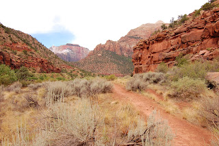
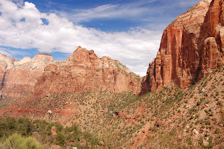
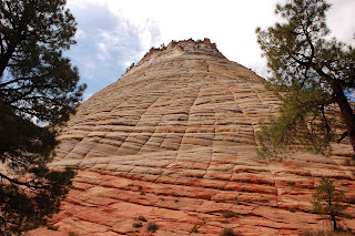
Zion View 1Zion View 2Zion View 3Checkerboard MesaSeeing as the rain was putting our hiking plans for today on the back burner (we planned to hike to Lower, Middle and Upper Emerald Pools today – the Narrows was a first thought, but we opted to skip that with the threats of flash floods.), we parked the car at the visitor center once again and took the shuttle to the Zion Lodge up-canyon. We browsed the gift shop for a bit and the rain still hadn’t let up. We debated what to do for a few minutes and finally decided to sit down for a good breakfast, headed upstairs to the restaurant at the lodge and ate there. We finished up around 9:45am and it was still pouring (and quite foggy too). So, we got back on the shuttle and went down-canyon to the Zion Human History Museum. We spent about an hour there and the sun finally decided to make an appearance. By this time, it was 11:00am and too late for us to do the hike we wanted (and still get to our next stop at a decent time). We figured the next best thing would be to drive back towards the East entrance (through the tunnel again) and take some pictures of stuff we didn’t on the way in yesterday. Back on the shuttle, back to our car at the Visitor Center, and on the road again. The drive (and photo stops) there and back took us just over two hours and the sun even stayed out the whole time.

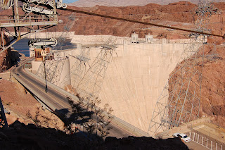
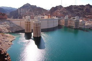
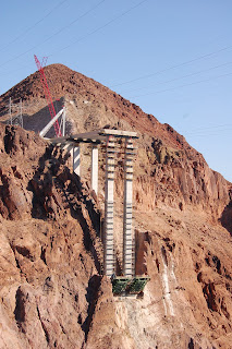
Hoover Dam 1Hoover Dam 2Start of the Bridge in Progress at Hoover DamGot back on the road about 1:30pm and headed west towards Las Vegas, NV. When making our trip itinerary, I didn’t consider the fact that an afternoon departure from Zion would put us driving through Vegas during rush hour. We hit Vegas at about 4:30pm and, surprisingly, never drove any slower than 45mph. Either rush hour comes at a different time in Vegas, or they have something figured out a hell of a lot better than Portland does. We made it through Vegas in no time at all and hit Hoover Dam about 5:30pm. We only stopped long enough to take a few pictures and ooh and ah at the grandiose structure. We also got a glimpse of the bridge that is under construction that will eventually re-route all the traffic that currently goes over the dam. We crossed the dam into Arizona (and into the ‘Arizona’ time zone as they do not observe daylight savings time) and continued through some of the most boring scenery for a few hundred miles (really, this rivals Wyoming – only straighter roads).

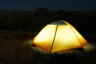
Our TentTwo and a half hours after crossing the Hoover Dam, we reached our campground in Seligman, AZ on historic Route 66. By campground I mean a KOA Kampground. Anyone who has been camping at a KOA before knows (or should know – I hope) that KOAs are typically RV parks with luxuries and are only a stop of convenience for tent-camping folk. And that’s exactly what this one was. The Seligman KOA is conveniently situated between Route 66 and I-40. Actually, it’s between somewhat noisy Route 66 and the even noisier train tracks that run alongside I-40. Regardless, it was a place to pitch our tent in the general vicinity we wanted to be in for tomorrow. And – equally as important – it is a place with showers. We checked in and picked a campsite at the far corner (away from other people and RV generators), set up camp, and went straight to the showers. One thing I really like about camping is how much it makes you appreciate simple things – like showers, running water, microwaves, etc. (you get the point). A good half hour later, I emerged a new person. Daniel cooked dinner (okay, boiled water and dumped it into a bag of freeze-dried food – but it was really good!) and pulled out the laptop to download our photos thus far to the computer. I took advantage of the free wi-fi (a perk of many KOAs) and posted my journal to my blog. Bedtime came sometime around 11:30 or midnight – maybe not the smartest thing since we are hiking 10 miles tomorrow…

Wildlife seen: mule deer, wild turkeys

Labels:

Sunday, August 26, 2007

Day 3 – Bryce Canyon National Park, UT to Zion National Park, UT

Miles driven today: 108
Cumulative miles: 1158

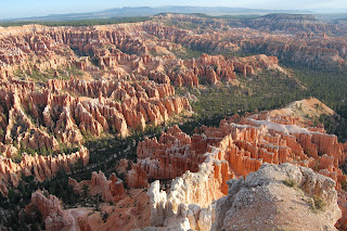
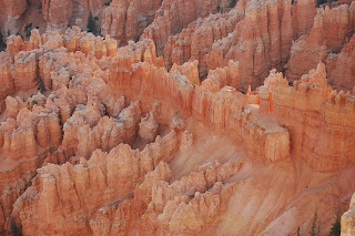
Another View from Bryce PointHoodoos at Bryce PointWoke up a little after 6:00am to break down camp and go see the canyon at sunrise. We didn’t quite make sunrise, but got to Bryce Point just as the sun came out from behind the clouds. We spent quite a while there taking photos before heading to Inspiration Point for more of the same. Decided to stop by the Visitor Center for our standard souvenir (a book) and also picked up a US National Parks Passport to record our visits.

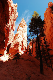
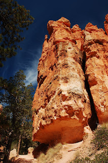
On the Navajo Loop TrailAnother View Along the Navajo Loop TrailBy 10:00am, we were at Sunset Point to begin our hike. We made some oatmeal in the car using our 12volt hot water heater (thanks Mom!) before setting out. We decided to do half the Navajo Loop Trail (the Thor’s Hammer side) into the Queen’s Garden Trail, up to Sunrise Point, where we took the Rim Trail back to our car at Sunset Point. In all, it was a 2.8-mile hike, descending about 550 feet into the canyon and back out again. It took us about an hour and 45 minutes for the entire hike. When we got back to the car, we decided to set up the tripod for a picture of the two of us (we are notorious for not getting photos of us together on trips). We finished up and got back in the car just as it started to sprinkle. I figure out timing was on today between finishing our hike before the rain and catching the sun just as it came out from the clouds this morning.


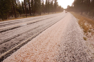
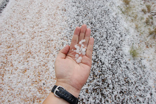
Hail on the RoadLook at the size of the Hail!Our plan for the next few hours was to take the scenic drive out to Rainbow Point and stop at the other viewpoints along the way. As we drove, the rain worsened. It kept getting heavier and heavier until visibility was down to about 20 feet – and then the hail came. It was so load on the car that Daniel and I had to shout just to talk. When it was all said and done, there was about a half inch of pea-sized hail on the road and the ground appeared snow-covered. We made it the 8 or so miles to Rainbow Point (where, oddly enough, it was completely dry) and then toodled our way back up the road (the main road in the park ends at Rainbow Point, so you have to leave the same way you came in.

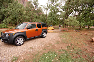
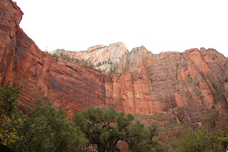
Our CampsiteWe left Bryce Canyon at about 1:45pm and got on the road to Zion National Park. It rained off and on for most of the 80-mile drive, but cleared up just as we arrived at the entrance to Zion. We came in from the East Entrance. I recommend coming in this way as you start near the upper part of the canyon/ formations and slowly zig zag your way down to the canyon floor. It makes for a more dramatic impression of Zion. So, we worked our way through the park, past Checkerboard Mesa and other formations, and finally to the mouth of the Zion – Mt. Carmel Tunnel. The tunnel is 1.1 miles long and passes through the canyon wall, emerging on the other side about 800 feet above the floor of the canyon. That in itself is pretty cool, but to know that this feat of engineering was completed back in 1930 is even more impressive. It had just begun to sprinkle as we entered the tunnel. A few minutes later, when we emerged, the sprinkles had turned into a downpour. This continued for about the next hour or so without letting up. We opted to sit in our car at the Visitor Center for about 20 minutes until it finally did let up a little. Went to check in and set up camp at Watchman Campground near the Visitor Center. We went to our assigned spot and found that we also had our own lake at our campsite too. At least that showed us the low spot and where not to put our tent.

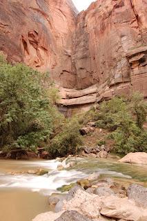
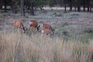
View Along Shuttle RouteRiver at Temple of SinawavaAfter we got set up, we headed back to the Visitor Center for a quick look around before boarding the Zion Canyon Shuttle (due to the congestion caused by 2.4 million visitors per year, the free shuttle system was implemented and cars are no longer permitted up the canyon). We rode the shuttle to the final stop at the Temple of Sinawava so we could hear the entire audio tour and decide which hikes to do tomorrow. At this stop, we took a short walk back to the river and took photos for about a half hour before it started to rain again. Got back on the shuttle for the ride towards camp. On the way back down the canyon, we saw wild turkeys and several mule deer.

Back at the campground, we started making dinner when a buck decided to graze through our campsite. We watched him for a good 10 minutes before he moved on. Finished dinner, cleaned up, and went to bed around 9:30pm so we could get an early start hiking the next day. (Side note: we learned that the only showers were outside the park in the town of Springville and closed at 8pm – I’ll have 3 1/2 days of camp funk before we make it to a shower. Ug!)

Wildlife seen: mule deer, wild turkeys, bats

Miles hiked: ~2.8

Labels:

Saturday, August 25, 2007

Day 2 – Ontario, OR to Bryce Canyon National Park, UT

Miles driven today: 664
Cumulative miles: 1050

Got up about 7:30am and managed to leave the hotel around 8:15. About 10 minutes later, we left the Beaver State and entered Idaho (the Gem State). The only drastic difference (not that there should be one) was the speed limit. Oregon’s speed limit on I-84 is 65mph whereas Idaho’s is 75mph. Add on the 5mph over that everyone drives and that equates to 80mph and crappy gas mileage.

Our first scheduled stop today was at Sonic in Caldwell, ID. I know it may seem a little ridiculous to schedule a stop for a fast food restaurant, but I grew up with Sonic’s (in Texas) and there is only on near home (about an hour drive), so we needed our fix. Besides, what better way to start the day than a Route 44 Cherry-Limeade and a fresh Strawberry Fruit Slush?! So, we continued on and drove, and drove, and drover – through Boise, Idaho, on to Utah, through Ogden, Salt Lake City, and even through Beaver, Utah – with a few stops for refueling and refilling (our tummies). Again, a fairly uneventful day of driving (we did see one accident immediately after it happened – a piece of sheetrock came off the back of a pickup truck and busted the windshield of the SUV following them).
We finally got to the turn off for Bryce Canyon and had just another 60 or so miles to go. The scenery was mostly blah with some farmland and plenty of dead grass. The dust along the drive was bas at times too and we saw several dirt devils come and go. Anyway, we were driving along and turn a corner and BAM! We’re suddenly in the middle of spires of rock (hoodoos) in shades of red and orange. This is the start of the Dixie National Forest and we were in Red Canyon. The sun was behind us making the colors even more vibrant. The red rocks literally started in the middle of a hill. One half of the hill was just that, a boring hill. The other half was solid hoodoos and rock formations. It just seemed out of place. After stopping for a few pictures, we continued down the road to Bryce Canyon National Park. We went through the Entrance Station and about 30 seconds later we saw several deer. We went all day seeing only one deer off in the distance, then, no sooner than we enter the park, there’s a ton of them. It’s like they know that this is a safe place for them. Daniel speculated that maybe they put in underground fences and put shock collars on the deer to keep them in.

View from Bryce PointWe continued on to Sunset Campground. We didn’t have reservations for tonight as this is a first come, first serve campground, but we found a spot no problem, pitched our tent, quickly set up camp, and took off to Bryce Point to see the canyon before it got too dark. We saw more mule deer, including on buck, on our way. Stayed at Bryce Point for about a half hour taking photos and taking in the scenery before heading back to camp for dinner.

We picked up a bunch of Mountain House and Backpacker’s Pantry instant meals (just add hot water) for a majority of our dinners. Can’t complain so far – quick, easy, relatively cheap, and tasty too. We ate dinner, cleaned up, made a plan for the next day, and headed to bed around 11pm.

Wildlife seen: mule deer

Labels:

Friday, August 24, 2007

Day 1 – Vancouver, WA to Ontario, OR

Miles driven today: 386
Cumulative miles: 386

Daniel spent the day loading the Element (our car) and finishing up with all the last minute to do items before heading out on our 3+ week road trip. I spent the day at work making sure everything was in order for me to be gone. Daniel met me at work (Mom dropped me off this morning so Daniel and I could head out from there) and we headed east around 4:00pm. Since Dad just flew in today from his current job in Northern Alberta, Canada (only for the weekend and he may be assigned to his next job – Saudi Arabia? – before we return), our first stop was near Gresham, OR to meet for a quick bite and say hi/ bye.

Got back on the road again at 5:45 going east on beautiful I-84 through the Columbia River Gorge. The drive was nice and uneventful (which is a good thing on a car trip). Our only stop was in La Grande, OR to get gas. I believe that Oregon is one of only two states in the US where you do not pump your own gas (the other being New Jersey?). Some people say, “Awesome, I don’t have to pump my own gas.” Sounds great… in theory. In actuality, it means ‘I can’t pump my own gas’ or ‘someone else has to pump my gas.’ And if that someone else only works until 10pm, then the gas station closes. Hence the first minor dilemma – finding an open gas station in the small town of La Grande, OR (ironic name, huh). So, we got to see most of the town and managed to find an open gas station. We finally pulled into the Safeway gas station where we were helped by a friendly and talkative attendant – from Guam. Now, how you end up in a small town in the middle of nowhere from Guam, I’m not sure. Anyway, the attendant was asking us about our car while the gas was pumping and while he was scrubbing hundreds of bugs off our windshield. This is a service that, for whatever reason, we don’t normally get back in Portland. This leads to my next minor dilemma – are you supposed to tip the attendant for this service? Neither Daniel nor I were sure, but we thought it would be the nice thing to do. Then we discovered that all we had were big bills. So, we didn’t tip and felt a little guilty and we still don’t know the proper etiquette.

Back on the road again and we continued to Ontario, OR (near the border of Idaho) where we had hotel reservations for the night. Got checked in around midnight local time (11pm at home). The plan for tomorrow is to get an early start as we have about 10.5 hours of driving to reach Bryce Canyon, UT tomorrow evening.

Wildlife seen: 2 deer (butts)

Labels:

Thursday, August 23, 2007

Road Trip 2007

Daniel and I will be taking a 3+ week road trip from Aug 24 - September 16. I'll be posting my journal of the trip here as I have access to the internet (not sure when that will be necessarily). Hope to post some pics to when I get home. Enjoy!

Labels: