Click to see larger view

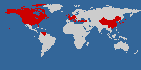
    Countries I Have Visited


    The Ultimate Hitchhiker's Guide to the Galaxy

    Recently Read
    by Douglas Adams


    One Billion Customers: Lessons from the front lines of Doing Business In China

    Currently Reading
    by James McGregor


    The Valley of Horses (Earth's Children Series)

    Currently Reading
    by Jean Auel

What

should

it be?

Tuesday, September 11, 2007

Day 19 – Wind Cave National Park, SD to Mt. Rushmore National Memorial, SD to Devils Tower National Monument, WY

Miles driven today: 195
Cumulative miles: 4249

We got up about 7:15am from the worst night of sleep we’ve had on the trip. Not only was it stupid cold (the thermometer said the low in the tent was 36 degrees), our tent site was also sloped. We slept with our heads uphill and ended up in a pile in the lower corner of the tent. Our sleeping bags zip together (even though they’re mummy bags), which is nice for body warmth, but it also means that I had to fight Daniel’s burrito move all night (you know, grab the blanket – or sleeping bag in this case – and roll over so you are wrapped like a burrito).

I made breakfast for a change while Daniel packed up the sleeping bags and tent. We went to the Visitor Center for the 9:00am tour of Wind Cave. The tour lasted about an hour and a half. Our ranger was really good and is a caver herself (she has a Master’s in geology with a specialization in cave science). The tour group had about 25 to 30 people, which I think is a little too big to manage.

Daniel and I were near the back of the group and got stuck behind possibly the most annoying and stupidest couple on the tour. Every fifteen feet, the woman would say “Now that’s cool” or “Isn’t that cool?” and then proceed to take a flash picture just a foot or two from my face. Her husband, who was in front of her, would say “Now look at that” as he touched whatever it was. He would also touch the wall with his hands on every step that he took if the wall was close enough. Anyone who has been on a cave tour knows the first and last things you are told is “DON’T TOUCH!!” It’s not just that the cave formations are fragile and could break, but also that the dirt and oils on your hands transfer easily from your hands into the rock and permanently stains and damages it. I understood this concept when I was five and went on my first cave tour (that I remember). Somehow this is lost on these two 40-something year old adults. I was just about to ask them if they were deaf or just stupid when we got to the next large room and stop on the tour. I took this opportunity to move way ahead of them in the group – I figure when that part of my personality (which I get from my dad) starts to come out, it is better to remove myself from the situation rather than cause trouble.

Back to the tour. Wind Cave is currently the fourth longest cave in the world at 124 miles long (behind Mammoth Cave in Kentucky – 367 miles, Jewel Cave in South Dakota – 140 miles, and Optymistychna in Ukraine – 133 miles). New passages are being found in Wind Cave at a rate of 5 miles per year, so this rank could change. Wind Cave is famous for its boxwork, which is a calcite formation, formed when the limestone encompassed by the calcite (the calcite filled the cracks in the limestone) eroded away, leaving the calcite ‘boxes.’

After the tour, we spent some time at the exhibits in the Visitor Center, then drove north through the park and into Custer State Park. While there, we saw bison, wild asses, prairie dogs, turkeys, mule deer, and antelope. We continued north toward Mt. Rushmore on Alt-16. This was a nice off-the-beaten-path kind of drive. We went through three narrow, one-lane tunnels that had been blasted out of rock – two of which you could see Mt. Rushmore in the distance as you emerged.

The road twisted and turned its way through a forest of Pine trees and we finally arrived at Mt. Rushmore National Memorial about 1:20pm, nearly two hours after we left the Wind Cave Visitor Center. We had lunch at the Memorial and then did the .6 mile Presidential Trail Loop that starts at Grand View Terrace, goes up close to the base of the mountain, by the sculptor’s studio (which was closed) and back to the Terrace and Visitor Center. We did get to see a mountain goat near the entrance before we left at 4:00pm.

We made the hour drive to Jewel Cave and stayed there less than five minutes. Apparently they close at 5:30pm, so we missed the last tour of the day (the info I had printed out didn’t have tour times beyond Labor Day). Not a big deal – it just gives us another reason to come back.

We continued west to Wyoming, where we literally saw hundreds of antelope. At one time, we saw a herd of about 50 in a field. The drive to Devils Tower National Monument took about two hours after leaving Jewel Cave. We were able to see the tower in the distance for a short time as we drove, then the hills blocked the view until we were about five miles away.

Since the sun was going down, we drove around the tower from the entrance on the east side to the Visitor Center on the west side so we could see the tower with the evening sun shining on it. It only took about ten minutes after we got out of the car for the light to completely change and become too dark for photos.

We drove the two miles back to the campground turn off and went to pick a campsite. Of the two loops of sites at Belle Fourche Campground, one of them was closed (for the season I’m assuming). That knocks out half the sites. On the open loop, two sites were blocked off for no apparent reason and three sites were designated as group sites. All of the other sites were full except for one. We went ahead and set up camp in the only site. (This campground also doesn’t allow campfires, so we’re still stuck with the two bundles of firewood that we bought at Great Sand Dunes and didn’t use there.)

We made dinner about 8:30pm and went to the tent shortly thereafter. We played games in the tent for a while (we would have played at the picnic table, but the cold was setting in – it didn’t feel as cold as the previous night, but our thermometer battery died so we couldn’t check) and went to sleep around 11:00pm.

Wildlife seen: (More variety and quantity today than any other day) bison, wild asses, prairie dogs, turkeys, antelope, mule deer, white tail deer, mountain goat, hawk, squirrels, chipmunks

Miles hiked: ~2.0

Labels:

Monday, September 10, 2007

Day 18 – Wheat Ridge, CO to Crazy Horse Memorial, SD to Wind Cave National Park, SD

Miles driven today: 426
Cumulative miles: 4054

We had planned to get up around 7:30am so we could say goodbye to Amanda before she left for work (Dave had the day off) and get an early start, but Amanda knocked on the door about that time to let us know she wasn’t feeling well enough to go into work in the morning. So, we slept in until 9:00am. When we got up, we finished packing and hung out for a while.

We left their place about 11:00am, made a couple of wrong turns due bad signage, and finally got on the right direction. We made a couple stops for gas, bathrooms, a food stop, and a Love’s stop for Robertson’s Jerky (the only place I know to find it and we don’t have any Love’s close to us). We spent six and a half hours driving today. It sounds bad, but it really wasn’t. Good music, good company, and a good car I think made the time pass fast. Daniel thinks that me driving instead of him (so he can download pictures or read or whatever) has something to do with it.

Almost as soon as we got into Wyoming, we started seeing antelope. When we got into Wind Cave National Park in South Dakota, we drove past a huge herd of bison, we saw deer at the campground, and we also had to wait for the wild turkeys to get off the road so we could go by. We got to our campsite at 5:45pm and by 6:00pm we had the tent and sleeping bags all set up. We left the campground to drive up to Crazy Horse Memorial. On the way there, we had 14 wild turkeys cross the road in front of us.

We arrived at Crazy Horse at 6:45pm. The stone carving is still in progress. Carving began in 1948 with a crew of one, Korczak Ziolkowski – he has since passed away and seven of his ten children and his wife continue to work on Crazy Horse. Korczak, who was an assistant sculptor on Mt. Rushmore previously, was asked by Lakota Chief Henry Standing Bear to carve their great hero into the Black Hills as well. Korczak agreed and believed the public should choose to pay for this on thief own accord. He twice turned down large sums of government funds and the project continues to be funded solely by donations and contributions (including equipment and dynamite).

There has been a lot of progress since I last saw Crazy Horse Memorial (in 1994). As I recall, they had a rough outline of Crazy Horse’s face and arm blasted out and his horse’s face painted on the rocks. Now, the face has been completed and further progress has been made in removing rock around the arm and horse. When the memorial is completed, it will stand 563 feet tall and 641 feet long. For perspective, Mt. Rushmore faces are 60 feet tall, the Statue of Liberty is 306 feet tall from the bottom of the pedestal to the top of the torch, the Washington Monument is 555 feet tall, and the St. Louis Arch is 630 feet tall. There is also no estimated completion date for the Crazy Horse Memorial as this is dependent upon donations and the challenges of the project.

We took some time to photograph Crazy Horse before daylight faded and browsed the exhibits. About 8:15pm, they lit up the carving from below. A half hour later, the laser light show, “Legends In Light,” began. We watched from the deck of the Welcome Complex facilities where there was an audio presentation to accompany the laser light show. I set my camera up on a mini tripod during the show and took about 90 pictures (it’s digital, so it’s free and easy to delete). A significant number of them actually turned out good. Being on a tripod, I was able to take pictures and watch the show at the same time. The show lasted about 25 minutes. It was dry but pretty cold (there were small amounts of snow on the ground there) when we left at 9:30pm.

We got back to the campsite at 10:15pm and cooked dinner. We ate in the car since it was so cold out. Our digital thermometer said it was 42 degrees outside. We let it adjust again when we got in the tent – it said it was 48 degrees. Fortunately Daniel brought both our light weight backpacking sleeping bags and our heavier weight camping sleeping bags (one is good down to 30 degrees and the other to -10 degrees). Daniel read and I wrote while we listed to the elk bugling before we finally managed to fall asleep.

Wildlife seen: antelope, bison, prairie dogs, turkeys, mule deer, camels (in a fenced field)

Labels:

Sunday, September 09, 2007

Day 17 – Wheat Ridge, CO and Denver, CO

Miles driven today: 2
Cumulative miles: 3628

I got up at 8:30am and Daniel rolled out of bed a good half hour later. We decided to check the Colorado Rockies (Major League Baseball) schedule and see if there was a game today. Turns out they were playing against the Padres at 1:09pm and tickets were reasonable ($4 to $75 each). Daniel picked out seats and got tickets for him, Amanda, and me.

Since the game wasn’t until later, Daniel and I went to the auto parts store for some oil and a filter (being nearly 3,700 miles into the trip, it was definitely time for an oil change). Daniel changed the oil and we chilled out for a bit.

Sometime after 12:30pm, we walked a short distance to the city bus. The ride was about 30 minutes, but I napped through most of it (I can sleep just about anywhere). We got off the bus just a few blocks from Coors Field where the Rockies play. It was a little chilly, but it was fun to spend the afternoon watching baseball (neither Daniel nor I had been to a major league game in the ten and a half years we’ve been together and Amanda hadn’t been in years either). The Rockies won 4-2 and we left the stadium around 4:00pm. The bus didn’t come for another half hour or more because of traffic, so we didn’t get back to the house until after 5:00pm. At least this gave Dave some quiet time to work on homework.

We all decided on Italian for dinner, so Dave called in a take-out order and he and Amanda went to pick it up a short time later. The food was excellent and the portions huge, so I think there will be enough leftovers for at least a week.

We watched a DVD of MXC (Most Extreme Challenges) which is footage from an eighties Japanese game show called Takeshi’s Castle that is dubbed over with funny commentary. The challenges are ridiculous things like roller skating in a horse suit, swinging on a rope over mud to try to land on a tiny platform, or running through a maze while being chased by monsters. If you’ve never seen it, it is good, stupid fun to watch.

I managed to make it through the whole DVD before the full stomach and fatigue made me pass out on the couch before 8:00pm. I was crappy company and told Amanda and Dave that it’s actually a compliment that their house is cozy and comfortable enough to fall asleep on the couch. Their cat must’ve thought we were cozy and comfortable, too as he curled up and slept on me and Daniel. Their other cat is a little more shy. He came out to see us this morning, but seems to have forgotten that we are okay people and went into hiding again. Their dog, on the other hand, seems to like everyone. Daniel woke me up about 10:00pm and we all headed to bed.

Miles hiked/ walked: ~.5

Labels:

Saturday, September 08, 2007

Day 16 – Wheat Ridge, CO, Golden, CO, and Denver, CO

Miles driven today: 32
Cumulative miles: 3626

We woke up at 8:30am and got ready. We pulled out the laptop so we could figure out our plans for the rest of the day and let Daniel’s cousins know when we would be at their place in Butte, Montana. In the process, we decided we would take it easy while visiting Dave and Amanda and stay a day longer than we had originally planned. This would allow us to see Dave a little more since he ended up having to work all weekend and is trying to stay caught up on school work, too. Since we took out two nights by modifying our trip earlier on, we’ll still be getting home a day early, which means we’ll have next Friday night to sleep in our own bed and won’t have to leave until Saturday afternoon/ evening to go camp at Mt. St. Helens before doing the Rim climb on Sunday.

With all that figured out, we let the house around 10:45am and drove the short distance to Coors Brewery, CO. I had been on the tour before when I was much younger; Daniel had never been on a large scale brewery tour, only microbrew tours (as are most prominent in the northwest). The tour is free and you get three samplers at the end of the tour (not a full ping of course, but about 10 oz. Glasses). They didn’t have Keystone (can’t say I was disappointed about that) or Molson, but they did have a variety of other beers including Killean’s Irish Red (which they bought and didn’t change the recipe) and two Blue Moon beers (whose recipes were developed by Coors Master Brewers). We learned that Coors uses hops from Washington State; that the facility is very environmentally friendly – they recycle everything they can and make animal feed pellets from the mash (they can produce 500 tons per day); that Coors made malted milk during prohibition in order to keep the factory open and keep the workers employed; that employees get two beers after each shift; and that the wellness center/ gym also has beer on tap. At the end of the tour, Amanda, Daniel, and I each enjoyed a beer or two (actually, the klutz that I am, I spilled most of mine on the table) and went to the gift shop to buy our tickets for Elitch Gardens, an amusement park in Denver.

After leaving Coors, we made a lunch stop at Chipotle and then went to Elitch’s. When I’m at an amusement park, I instantly become a kid again and get super excited about the rides – especially roller coasters. Amanda is the same way and Daniel likes roller coasters a lot, too. Of the six roller coasters at Elitch’s (it isn’t a huge park), we went on five of them. There’s one where the roller coaster cars are attached to the track at the top and your lower legs and feet dangle, another that goes forward and then takes you backwards through the course, a wooden coaster, a loop-dee-loop coaster, and a coaster where you essentially lay on your stomach looking forward, a la superman (this one twists and turns and goes upside down, too). We also went on the Tower of Doom, which is a free fall from several stories up. I also had the bright idea of going on the wettest water ride in the park. At least we did it early enough in the day that we were mostly dry by the time we headed to the car, but not early enough to freeze as the evening began to set in.

After several rides, some funnel cake, and plenty of obnoxious high school cheerleaders (apparently it was Rally Day at the park and there were hundreds of cheerleaders wearing some incarnation of their uniform – from full game uniforms to personalized warm-ups), we got to the house about 8:00pm. We changed into warmer clothes and headed out for good Mexican food about 9:00pm. Dave drove us around for a while after dinner so we could see the city lights at night. We went to Lookout Mountain where you could see the Coors brewery in Golden and see the lights of Denver. He also took us to the parking lot of a church up on a hill close to where he grew up. He used to come up here with his friends to hang out and talk. We did just that as it was starting to rain and was too cold to get out of the car. We finally got back to the house about 11:45pm and all went to bed as Dave has to be to work early in the morning.

Wildlife seen: cheerleaders (I figure they must count as they are unpredictable and it is safest to view them from a distance)

Miles hiked/ walked: est ~3.0

Labels:

Friday, September 07, 2007

Day 15 – Great Sand Dunes National Park, CO to Royal Gorge, CO to Wheat Ridge, CO

Miles driven today: 325
Cumulative miles: 3594

Daniel woke me up at 2:00am saying he couldn’t sleep. I told him that he could read and the light wouldn’t bother me. He said that he had been trying to go to sleep for a half hour and every time he heard a noise, he thought it was a bear. I had been a little scared earlier about the bears, but forgot about it once I fell asleep. We ended up taking the sleeping bags and pillows to the car where Daniel read and I wrote for the next hour before managing to fall asleep again (no bear sightings).

We got up again at 8:30am and took down camp. We drove the short distance to the Dunes parking lot. We spent probably an hour and a half walking out in the dunes and still only made it a little beyond the foothills. Every step was laborious and the wind was filled with sand. I took my camera out for some photos before it picked up too much. When we got to the point where we wanted to turn around, I couldn’t even take out the camera to get the shot I wanted (the bigger dunes with the mountains behind them) because we were afraid the sand would pit the expensive filter and get into the camera.

We left the park at 11:00am and drove for a while before stopping at Sonic in Salida, CO. We went through the drive-thru and just ordered drinks. When we were the second car from the window, someone came out to give us our order and take our money since the car in front of us had an order that was taking longer. Daniel looked in the rearview mirror to see if he had enough room to back up and get out of line. He saw the car behind us getting closer. Then our car lurched forward. I thought Daniel had accidentally killed the engine, but he said “We just go run into.” I got out and looked at the back bumper. The woman who ran into us shouted “Sorry! I was looking at the car behind me.” I’m not sure how that makes her take her food off the brake and run into us. The damage was minimal (just some scratches on our bumper from the bolts that hold on her license plate). Daniel and I decided that it wasn’t worth exchanging info and filing a claim (and neither of us were injured from the impact at less than 1 mph), so we just went about our business. I’m a little bummed as this is the first ding of any kind to the Element and we have less than 11,000 miles on it. On the other hand, if that’s the worst that happens to us this whole trip, then I think we’re in pretty good shape.

We continued on and got to the Royal Gorge around 2:45pm. I was a bit appalled because the last time I was here (though it was probably 20 plus years ago) I recall there being a bridge to walk or drive across, a cable car in which you could ride across, or an incline rail car to take you to the bottom of the gorge to see the Arkansas River. There was likely a gift shop, maybe one other building, and a train down in the gorge. Now, however, there is an entire mini-amusement park built around the bridge and an admission fee of $23 per person to go inside. I asked if there was a bridge only ticket we could buy and was told there was a bridge only discount – if we got out of the park and back to the ticket window in less than an hour, we could get $7 back per person, making it $16 each. We decided to go ahead and do it since we were there.

We went inside the park, walked the entire span of the suspension bridge, looked down the 1,053 feet to the Arkansas River, tried to buy funnel cake but found most of the shops and concessions closed, paid a quick visit to the gift shop and found mostly crap not even related to Royal Gorge, and then left. We skipped the carousel, petting zoo, and the few other attractions (I don’t even know that the zoo was open and there was definitely no old west gum show while we were there). In all, we spent 47 minutes in the park, so we got our discount.

Our friends that we are visiting in Denver were just here last weekend for their first anniversary. They had a great time, but the differences were that they had at least a day to spend at Royal Gorge and were able to take the lunch train and it was also before Labor Day, so the park was still fully open. I’m sure it would be more enjoyable that way and I probably wouldn’t recommend this to anyone who just has an hour or two to spend there.

We continued on headed towards Cripple Creek. I was navigating and told Daniel to go a different way than the signs indicated. I was using Streets and Trips and the atlas and saw that the route I had picked had an unpaved road, but at least it was listed as a country road (CR-9) instead of just ‘local road.’ It ended up that this route was part of “The Golden State Back Country Bi-way” (or something like that). The scenery was very pretty, the road wasn’t too rough, and we got to see remnants of old mines along the way.

We got into Cripple Creek around 5:30pm. This is another place that has changed significantly since I last visited. Instead of the small, old mining town with charm where I first ate a buffalo burger and panned for gold, it is now a fairly commercial town with a big casino.

Daniel and I decided to just drive through Cripple Creek and take with us the fact that at least the drive there was pretty. We had considered driving up to Florissant Fossil Beds from here, but we were both getting a little burnt out on driving and still had about two hours before we would reach our friends’ place outside of Denver, so we decided to skip Florissant.

We passed Pikes Peak along the way. It is 14,115 feet tall, 3,000 feet taller than Mt. Hood in Oregon (11,249 feet), but seems much smaller since the surrounding area is already at about 6.000 feet (whereas Portland is at 76 feet above sea level and the area closer to Mt. Hood isn’t a whole lot higher). Pikes Peak is also a big dirt mountain caused by uplift with a road and train up to the top rather than being a volcano with glaciers and no road to the peak like Mt. Hood. We may try to drive back down to Pikes Peak and Garden of the Gods tomorrow from Denver, but we aren’t 100% sure yet.

We got to Dave and Amanda’s (Amanda is my best friend from undergrad – she met Dave and moved here a little more than three years ago) in Wheat Ridge, CO at about 7:40pm. I had told them earlier in the day we would be in about 7:30pm, so ten minutes off (because of traffic and construction) isn’t too bad. Dave had already left to set up for his band’s (Visitor 8) show, so we hung out and chatted with Amanda until 8:30pm when we left to go to the show. Amanda took us on the scenic route to show us the two other places she had lived and where she works.

We got to the venue (a community arts center) at 9:00pm and headed inside for the opening act. I can’t say I’m a big fan of computer-generated electronic ‘music’ accompanied by occasional banging on pans or drums and singing/ talking into a microphone hooked up to some sort of voice-altering synthesizer, but I do applaud the one man act for having the confidence to get up and perform in front of everyone. I’m still not quite sure I understand the black vinyl outfit and five masks (one on each side of his head, plus front, back, and top, too) he was wearing. I’ll just take it as an expression of art and leave it at that.

We all headed outside about half way through the performance so we could talk. Dave’s band had less than an hour before they were supposed to go on and their guitarist still hadn’t shown up, hadn’t called, and had his phone turned off. Long story short, he said he had to work several hours late and couldn’t call anyone and the band had to cancel about 15 minutes before they were supposed to play. Dave was bummed that we didn’t get to see them play, but he showed us his drum set before he took it down and packed it up.

We went to the bar down the street for a quick beer, back to Dave and Amanda’s to drop off Dave’s drums and a car, then to Village Inn for dinner (not a whole lot of options for sit-down dinners after 11:00pm). We made it back to the house about 12:30am and went to bed.

Wildlife seen: mule deer, hawks, bighorn sheep

Miles hiked: ~2.0

Labels:

Thursday, September 06, 2007

Day 14 – Albuquerque, NM to Great Sand Dunes National Park, CO

Miles driven today: 246
Cumulative miles: 3269

Woke up at 8:00am and got all of our stuff packed up before heading downstairs for breakfast. While we were eating out on the patio, I got a text from my dad saying his next job assignment will be in Riyadh, Saudi Arabia. He’ll be headed over there in mid-October and my mom will follow in mid-November. He should be home at least one more time before then, so we will get to see him. I also found out that two of my friends from grad school who lie in Bangkok, Thailand will be getting married in January, so Daniel and I may try to go there for a week, if at all possible.

We visited for a while after breakfast and left just before 11:30am. Per Joel’s advice, we drove through Santa Fe and took 285 north almost all the way to Great Sand Dunes National Park. The drive took about 5 hours, but we got to pass through a lot of pretty scenery.

We got to the Visitor Center about 4:30pm and went in to have a look around. While we were there, we overheard the ranger saying there were four bears coming down into the park every morning (the dunes are backed up to the Sangre de Cristo Mountains, which are forested and very much in bear country). I’ve been camping in bear country before and it didn’t really bother me then. I think I was more intrigued than scared – I blame naivety. When my family took a vacation to Yosemite 12 years ago, there were bears all over the campground. I can remember watching them at the site next to us where the people had left food on the table. I also saw them roaming the campground, within 20-feet of us, when we were walking to the bathrooms. Our friends that were camping with us said they heard the bears brushing up against their tent fly in the middle of the night. And I still wasn’t scared?!? What was I thinking? I’m pretty freaked out now about camping in bear country.

Anyway, we left the Visitor Center and hoped to take some photos of the dunes, but the clouds were pretty dark and gloomy and made for bad, flat pictures. We went to the campground and set up our tent. Our rain fly was still damp from the storm we had while camping in Mesa Verde three nights ago. We probably should have dried it out at Jim and Jane’s, but it actually dried out in about ten minutes after setting up the tent.

Daniel decided he wanted a campfire, so we walked a short distance to buy some firewood. Before we even got back to the campsite with the wood, it started to rain pretty hard. We put the wood in the back of the car and then jumped up front.

We decided to go for a drive on the dirt road out to the Point of No Return. The road continues beyond that point, but it is recommended only for high clearance, 4-wheel drive vehicles and tire pressure at 15psi. The road up to that point was rough as it was, so we decided to turn around and drive back to camp.

The rain had slowed to a drizzle, but everything was soaked. By this time, we had about an hour until the ranger talk at the amphitheater. We sat in the car and played games for lack of anything better to do and another dry place to do it. While we were in the car, we saw four deer (two does and two bucks) walk into our campsite. We watched them for a few minutes, then one of them started licking the picnic table at our site. Another was rooting around in the ashes of the fire pit. At some point or another, all four of them sampled whatever was on the table. It could have just been water, but there was plenty of water elsewhere. Anyway, they continued this for more than five minutes and we were able to get the camera out to take some photos before they moved on.

At 8:00pm, we went to the amphitheater for the ranger talk about Black Bears and camping/ hiking in bear country. I dozed off sometime in the middle of the 45-minute presentation, so I can’t say I really learned much. We went back to our campsite and, as exhausted as I was, opted to skip dinner and go to bed. Daniel, who was still quite awake, stayed up reading.

Wildlife seen: magpies, deer

Labels:

Wednesday, September 05, 2007

Day 13 – Albuquerque, NM and Santa Fe, NM

Miles driven today: 150
Cumulative miles: 3023

I woke up to my internal alarm clock at 6:30am and lay in bed for a half hour before waking Daniel up. We got up and showered and went downstairs for breakfast. Two of the four grandkids (all of whom live across the street), Hannah and Missy, were there as Jim was taking them to school today. Jane made Swedish pancakes for breakfast and we ate out on the back patio. The temperature was perfect for eating outdoors, even at 8:00 in the morning.

Jim got the girls to school and then we headed towards Santa Fe (Jim drove). The drive there took an hour or less. The town is definitely more commercial than the last time I was there, but it was still nice and calm. We walked to the big old Catholic Cathedral (that I can’t recall the name of now) and went inside to have a look around.

Next, we walked a few block to Loretto Chapel. Apparently when they built the chapel, they didn’t leave room for a staircase to the choir loft. As the story goes, the sisters at the chapel prayed for some help with their predicament (they were going to have to take out several rows of pews to accommodate a traditional staircase). A carpenter with a gray beard showed up armed with a hammer and a saw and said he would build a staircase for them. He went to work building a spiral staircase. He worked by himself and never asked for money for supplies. The staircase makes two complete circles as it ascends and has no supports (not even a center post). Architects believe the staircase gets its stability from the double-helix shape (similar to that of DNA). After completion, the man disappeared just as mysteriously as he had shown up, without ever collecting pay for his work. At that time, it was not proper for the sisters to make conversation with a man, so they barely spoke with him and never got his name. It was also common at that time that the builder would not be paid until the commissioned work was completed, so there were also no written receipts which may have indicated who the man was. After he left, the sisters searched to find out where he got his supplies and if there was an open account that they needed to pay; they found neither. The staircase was originally built without handrails, but another carpenter was later commissioned to add them as it was a little scary to climb.

After the chapel, we meandered through the town, stopping in various shops along the way (we picked up a few goodies including a Green Chile Cookbook). We had a very good lunch at the Blue Corn Brewery (the same place Mom & Dad ate the last time they were in Santa Fe). Meandered some more and went into San Miguel Church. This is the oldest church in the U.S. The current chapel was built in 1610. The previous structure, the ‘Hermita de San Miguel,’ was built for Christian worship in 1598. And both were built over the remains of a kiva of the Analco Indians, dating back to 1300 AD (as confirmed by archeologist excavation in 1955). That means this has been a sacred site for more than 700 years.

Before leaving Santa Fe, Jim & Jane took us to see a Madonna carved in the back of a tree in some random parking lot. Jim, who has lived in the area his entire life, didn’t know about this until last year when my parents were visiting and a geocache led them there.

We headed back to Albuquerque and made a quick stop at the house to put the dinner Jane had prepared the pervious day in the oven before going to the National Atomic Museum. The museum holds inactive versions of the “Little Boy” and “Fat Man” that were dropped over Nagasaki and Hiroshima during World War II. They had other atomic weapons and information on the history of atomic weapons and atomic energy. We were only able to spend about 45 minutes at the museum before they closed – not near enough time to see everything and take it all in, but we’ll be back again (hopefully to see the Albuquerque Balloon Fiesta in the next few years).

We went back to the house to get ready for the family dinner this evening. About 6:00pm, Jim & Jane’s kids and their families started showing up. It’s been 15 years since I last saw Peter, Amy, and Andrew and no one looks the same. Plus there were more people there that I hadn’t met before than the ones that I knew (Peter’s partner Joel, Amy’s husband Jason, and their kids Vanessa, Zach, Missy, and Hannah). It was great to catch up with everyone, especially now that we are all adults. I remember the last time I saw them, Peter and Amy were in their late to early twenties and probably didn’t have much in common with 12 year old me. Andrew was 9, so we probably just had video games in common. Now that we’re all adults, the age difference doesn’t really matter and we have interests in common (Peter and Joel are into photography and the outdoors, Joel and Andrew are both into biology, etc). The Green Chile Chicken Tortilla Casserole and Apple Crisp that Jane made were excellent (so much better than the freeze-dried food that we’ve been eating for more than a week now).

Everyone left around 9:00pm to go home. Jim, Jane, Daniel, and I stayed up for a few more hours talking about travel, family, etc. before going to bed. I spent some time updating my blog and finally called it a night.

Wildlife seen: bison (in a refuge)

Miles hiked/ walked: ~1.0

Labels:

Tuesday, September 04, 2007

Day 12 – Mesa Verde National Park, CO to Aztec Ruins National Monument to Albuquerque, NM

Miles driven today: 309
Cumulative miles: 2873

The alarm went off at 6:30am and we got up to break down camp. The fly of the tent was soaked as it rained most of the night. We carefully removed the fly, shook it off, and put it on a tarp in the car to hopefully dry out. We finished packing up camp and decided we had time to shower before our 10:00am tour of Balcony House. We bought the tour tickets last night and were told by the Ranger that with the road construction in the park, it would take two hours to drive there from the campground. We left from the showers/ campground at 8:00am and arrived at Balcony House 40 minutes later. We used the 12-volt coffee pot to heat water and made oatmeal for breakfast while waiting in the parking lot.

A ranger showed up to give the 9:00am tour. I asked if we could take that tour instead of waiting an hour and he let us. There were a total of six people on the tour including us, so it was easy to move, listen, take pictures, and ask questions. To reach the 40-room Balcony House, you descend down a path, then down some steps, down more path, and then up a 32-foot ladder into the palace. Our Ranger this time was much more informative and friendlier than our Ranger last nigh. We went through the various rooms of Balcony House and worked our way to the other end where you have to crawl on your hands and knees through a narrow tunnel (built by the ancestral Puebloans) to leave the dwelling. You continue down a path, up another tall ladder, then up some steep steps carved into the rock face by the Civil Conservation Corps – CCC – the ancestral Puebloans used more rough foot and hand holds.

The tour ended about 10:00am and we went to check out the museum. There are a lot of great artifacts and information in the museum, but it could use some updating/ re-vamping. We still spent about an hour there before deciding to make our way out of the park. There are a few other sites in the park we would have like to visit, but with a portion of the park closed because it is now after Labor Day, we will have to come back another time.

After leaving the park, we stopped in Cortez for a quick lunch before getting on the road again. We drove for nearly two hours before reaching Aztec Ruins National Monument near Aztec, New Mexico. The funny thing about Aztec Ruins is that they are not Aztec ruins at all – they are ancestral Puebloan ruins. Apparently the early settlers mistakenly thought these were Aztec ruins and also named the town Aztec, so it stuck.

Although these ruins are from the same era (1200 to 1300AD) as Mesa Verde and Hovenweep, they are not in a canyon like those sites. Aztec Ruins is more out in the open. The site is a giant Pueblo with the second largest kiva that they are aware of. While the other kivas we’ve seen could comfortably be used by 12 to 15 people, this one could easily handle more than 100. The Great Kiva, as they call it, has been reconstructed, but, as we learned in the short talk we listened to at the kiva, the archeologist that they hired to reconstruct it didn’t even follow the notes and diagram he made when he originally studied this site. He made changes as he saw fit, adding or changing doorways and such. At least he made the perimeter the same size as the original so that we could still get an idea of the size of this massive kiva.

We toured the grounds for almost an hour after the talk before taking off towards Albuquerque. The drive took about three hours and was mostly uneventful except for some really hard rain for about 15 minutes and a cop driving in my blind spot for about three or four minutes while he ran my out-of-state plates (really, if I were to steal a car or to be running from the law, I think I would pick a less obvious car than a bright orange Honda Element).

We made it to Jim and Jane’s house (my dad’s cousins) right at 7:00pm and debated about where to go for dinner. Daniel finally said that Chinese dumplings sounded good, so we all went to P.F. Changs.

After dinner, we went back to the house and sat around a chatted for a good two hours until we could hardly keep our eyes open anymore. We figured out that the last time I was at their place was 15 years ago (I was 12) and I hadn’t seen Jim and Jane’s kids since then (I’ve seen Jim and Jane, and Daniel has met them a few times as they’ve been up to Washington to visit). Way too long. We finally headed to bed after 11:00pm – under a real roof on a real bed for a change.

Wildlife seen: mule deer, coyote, magpies, elk (in a refuge)
Miles hiked: ~1.5

Labels:

Monday, September 03, 2007

Day 11 – Hovenweep National Monument, UT to Four Corners, AZ/UT/CO/NM to Mesa Verde National Park, CO

Miles driven today: 144
Cumulative miles: 2564

We woke up at 6:30am from the best night of sleep we’ve had on the trip. Aside from about 10 to 15 minutes of wind just before we fell asleep, the campground was very quiet and peaceful. I guess that can be expected when only five sites out of 30 are occupied (including the camp host). Daniel cooked breakfast while I took down camp and unpacked and repacked the car. I discovered that Daniel lost a shoe sometime yesterday. We’re pretty sure it rolled under the car when he changed into flip flops at Double Arch. We are blaming the heat for him not remembering to pick it up. Ironic that earlier that day he was telling me how much he liked those shoes.

Anyway, we drove less than a quarter mile to the Visitor Center at 9:00am where our camp host was also working the counter. He was very helpful and let us know what to see and do in the area.

Hovenweep is an area that contains Puebloan ruins. The area we were in contains 11 sites in a canyon fed by a spring. The ruins we could see were all from structures built 800 years ago. The fat that these structures are still standing at all is a testament to the abilities of the Puebloans. The only rebuilding of any kind that has been done is for structural integrity and is barely noticeable.

We took the one and a half mile loop trail around the canyon to see the ruins at the Hovenweep site. It took about an hour and a half and the heat was bearable as it was only 11:30am by the time we finished. There are other sites with ruins as well, but these are less accessible.

Overall, I would say the campground and Visitor Center and facilities at Hovenweep National Monument were the nicest, cleanest, and most organized we have seen. This may be partially due to the remoteness and the small quantity of visitors to the Monument. The drive out of Hovenweep was much nicer than the drive in – being able to see more than 20-feet helps with that. The surrounding area was mostly fields as we suspected.

We drove for about an hour until we reached Four Corners. This is the site where Arizona, New Mexico, Colorado, and Utah all meet at one point. There is a platform with a plaque and a place where you can stand in all four states at once to have your picture taken. That’s about all there is to it – just a chance to say ‘been there, done that.’ There are plenty of Navajo booths lining the parking lot selling mostly jewelry. So, if that’s your sort of thing, then you could easily spend an hour or more perusing there.

We continued driving into Colorado and made it to Mesa Verde National Park around 2:30pm and went to the General Store to check in for camping. We were given a pass to go pick out a campsite. We drove by nearly all 395 sites (no, that’s not an exaggeration). We finally settled on a spot away from other tents and RVs, close to a bathroom (which we later figured out was out of order), and just a short walk to the showers and General Store. We went back to the store to officially check in, went back to camp to set up, then drove ten plus miles further into the park to go to the Visitor Center. There, we bought tour tickets for Cliff Palace and Balcony House. A ranger told us that Long House and Weatherill Mesa were now closed for the rest of the season (apparently Labor Day is the last day for these). No biggie as I’m sure we’ll make it down here for another visit in the future.

The tour we chose for Cliff Palace started at 5:00pm, so we made the short drive to meet our ranger for the tour. Our ranger was a bit crabby (at one point early in the tour, she asked me “Did he just drag you on this trip and you are bored to death?” Um, no. “I’m just taking it all in and am a quiet person with nothing to say right now,” I told her.). We’ll just attribute her crabbiness to this being her last tour and last day in the park before heading elsewhere – we think she was having some emotional issues.

Cliff Palace is a massive 150-room structure (probably the most recognized at Mesa Verde) set into an alcove high in the canyon, 120-feet below the mesa top. The cliff dwellings in the park date back to the 1200s and are mostly original. Some reconstructions or modifications have been made for the purpose of structural integrity only. Numerous kivas (underground ceremonial rooms), each with a fire pit and a sipapu (a hole in the floor that is a spiritual passage from the fourth world – the one in which we currently live – to the third world – the one from which the Pueblo believe we came). The sipapu is as important to the Puebloan culture as the cross is to Christians.

For being 800 years old, the structures are amazingly well preserved. The natural alcoves in which the cliff dwellings were built provide protection from the elements, helping to prevent rapid deterioration. Archeologists have used numerous dating techniques to determine the age of sites, including dendrochronology (a dating method in which tree rings from multiple trees in the same vicinity are compared to determine the age of a tree) on the pieces of wood found as floors, balconies, support, or roofs in the otherwise stone and mortar cliff dwellings. Based on the dendrochronology, which also shows climate changes, they believe that the ancestral Puebloans only stayed in these dwellings for about 75 to 100 years (though they were in this area for hundreds of years prior in pithouses and other structures on the mesas above the canyons) and may have left due to years of drought and, consequently, failing crops.

We also learned that numerous wildfires, caused by lightning strikes mostly, have burned 80% of the park’s acreage in its 101 year history as a national park. The most recent fires in 2000, 2002, and 2003 burned over 50% of the park, decimated 600 year old Piñon Pine and Juniper Forests (the oldest in the nation – charred remains are what is visible now throughout most of the park), but also revealed 600 plus mesa top sites that they didn’t know existed previously.

The tour wrapped up about 6:00pm just as it was beginning to rain. We got caught in a downpour on the way back to camp. By the time we got there, it had let up enough to cook and eat dinner. It was a bit cold and was sprinkling off and on, so we spent most of the evening in the car reading and writing until moving to the tent to play games before we went to sleep.

Wildlife seen: mule deer, owl, magpies, golden eagle, tanager

Miles hiked: ~2.0

Labels:

Sunday, September 02, 2007

Day 10 – Moab, UT to Arches National Park, UT to Canyonlands National Park, UT to Hovenweep National Monument, UT

Miles driven today: 268
Cumulative miles: 2520

We got up at 7:30am after kind of a crappy night of sleep. The air was perfectly calm last night when we went to bed, making the tent overly warm and making it difficult to sleep. Sometime in the night, a strong windstorm blew in. The tent shook and the rain fly flapped in the wind. It cooled down in the tent, but now it was so loud that Daniel and I both spent several hours tossing and turning. By the time we got up, the wind had stopped, the tent was warm, and the air inside was stale again.

We packed up camp and headed to the clean, free showers (okay, so you pay more at KOAs then at most National Park campgrounds to camp and are essentially paying for the showers up front, but at least you don’t have to get out five minutes into your shower covered with soap to feed in more quarters). Afterwards, Daniel made a quick breakfast; we re-stocked our Gatorade supply (water bottles and powdered Gatorade mix) and were on the road by 8:45am.

It was only about a 20-minute drive to Arches National Park. We spent some time at the Visitor Center and figured out which hikes we wanted to do in the park. We took our time driving out to Wolfe Ranch where we hiked the mile and a half out to Delicate Arch (3.0 miles round trip). The first bit of the trail is on a dirt path, then it crosses slickrock that is off-kilter to your right and going uphill. The path is designated by rock cairns (stacks of rocks) as it is quite easy to lose on the rocks. Back to a dirt trail for a while. Then, for the last third of a mile, you go along slickrock jutting out below a sandstone fin, only a few feet wide and 40-feet or so up from the ground at some points. Finally, you come around the edge of a bowl and on the opposite side of the bowl stands Delicate Arch, which has been hidden from sight the entire hike up to this point.

Moving around the upper edge of the bowl is tricky as it is both slick and slanted. Daniel and I worked our way around to get different vantage points for photos. It was difficult to capture the Arch without people in or around it as it seems that every yahoo has to have their photo taken with it instead of enjoying the beauty of the Arch itself. After a half hour at Delicate Arch, we made the hike back to the car, stopping briefly at the Petroglyphs on the way. The hike and photos, etc. took us just under two hours from start to finish.

A half hour drive later, we reached the Devil’s Garden Trailhead and caught a glimpse of the Devil’s Garden Campground where we had planned to camp next week. By passing on the ugly campground at Monument Valley, we also ended up passing on possibly the most beautiful campground on our trip (at least thus far). It sits out among the sandstone fins and formations and right near a trailhead to several arches. We took the shorter option for the trails as it was nearly 1:00pm and scorching hot. We walked the half mile round trip to Tunnel arch and Pine Arch.

Back to the car for a leisurely drive down to the Windows Section of the park and a 15-minute/ quarter mile hike to Double Arch for some photos and oohs and ahs. The sun was taking its toll on us, so back to the air-conditioned car for the drive out of the park and on to Canyonlands National Park.

We arrived there about 3:30pm and stopped by the Island In the Sky Visitor Center. Knowing that most of Canyonlands is accessible by 4-wheel drive only (85% of the park is back country; White Rim Road in the Island In the Sky Section is 100 plus miles long and takes two to four days to traverse with a 4-wheel drive vehicle), we opted to see what we could from the 23 miles of paved road (and we drove all 23 miles of it!) and take one short hike. We picked the Mesa Arch hike as it was only a half mile round trip and only took a half hour to do. It was also fairly easy, so we decided to leave our flip flops on for this one.

The scenery at Canyonlands National Park was beautiful. Both this and Arches National Park are on our list of places to come back and spend more time (preferably in cooler weather too). We only spent two hours at the park due to our vehicle limitations, the exhausting heat, and the long drive we had to make yet today.

By the time we got back on the road, Daniel’s sunburn was becoming more evident. Apparently he forgot the sunscreen on his arms and legs, so now he has sleeve and sock lines. (I got a little burnt on my neck and shoulders coming out of Supai, but they are better now.)

We looked at our route for the rest of the day and opted to take out the visit to Natural Bridges National Monument as it would be pretty late when we got there and even later when we made it to our campsite for the night. So, we drove south along the same highway we had driven up on yesterday. The only excitement being when I slammed on the brakes to avoid hitting a dog and our big flashlight flew from the very back of the car up to the gear shift. We decided that meant we needed to re-pack everything in the morning.

Two and half hours into our drive, we followed signs and our map and turned onto a dark road. I think we were driving through fields, but it was too dark to tell. We only passed a few cars going the opposite way and seemed to be going further and further out into the middle of nowhere. Our headlights were hardly useful along the way as there were no markers alongside the road, no reflectors, and the road lines were either non-existent or in desperate need of re-painting. The road itself could use some paving and patching as well. All I could really see were the shrubs creeping over the edge of the asphalt and the occasional bunny with a death wish running out in front of me. Every time we started to think we missed a turn, we would catch a glimpse of a sign saying Hovenweep (our destination) with an arrow – the signs were also in need of re-paining, so they were difficult to see.

After about an hour of this kind of driving and a few turns onto some even more primitive country roads, we saw the entrance sign to Hovenweep National Monument and the dim lights of the Visitor Center (closed of course since it was now 9:00pm). We followed the arrows to the campground and hoped there was an after hours pay station. Fortunately there was, so we took the loop around the campground to pick a site. It was pitch black except for a light at the bathroom and quiet except for crickets and other bugs. All we could see was whatever our headlights happened to hit – empty site, empty site, empty site, serial killer type van (you know, like what they always have them drive in the movies), more empty sites, another serial killer van, more empty sites, an SUV with a normal looking guy and a dog, more empty sites. We picked one near the bathrooms and, just a bit further on, we saw an RV and pickup truck at the camp host site.

We dropped our cash and information in the drop box and set up camp. We skipped dinner as we had a late lunch after leaving Canyonlands National Park. Instead, we spent about a half hour looking at our photos that Daniel had downloaded to the laptop and went to bed around 10:00pm.

Wildlife seen: deer, lizards

Miles hiked: ~4.25

Labels:

Saturday, September 01, 2007

Day 9 – Grand Canyon National Park, AZ to Antelope Canyon, AZ to Monument Valley Tribal Park, UT to Moab, UT

Miles driven today: 428
Cumulative miles: 2252

I woke up at 4:30am this morning to the sound of elk bugling. I nudged Daniel and he said he heard it several times in the night when he woke up (never mind also hearing our neighbors as late as 2:00am). I’ve never actually heard an elk bugle (that I remember), so it was pretty cool.

We had planned to get up early to watch sunrise. It sounded like a great idea last night, but Daniel wouldn’t hear of it when it actually came time to get up this morning. So, I slept for a while longer before getting up at 7:00am. About a half hour later, Daniel finally got up and we got camp packed up by 8:00am. Back to Market plaza one final time to buy some ice, then to Mather Point for a few more photos before heading East of out of the park.

We drove for about two and a half hours before reaching Page, Arizona where we hoped to find a tour available for Antelope Canyon (a famous slot canyon). We had tried to book one of the Photographer’s (designed specifically for experienced photographers) before we left home, but got an email back saying that tour was full. We decided to just wing it. Knowing that timing is everything when it comes to photographing slot canyons (the sunlight only reaches down into the canyon for a short time each day – the most popular photos show a beam of sunlight shining down to the canyon floor), we timed our arrival into Page to be about 11:00am. We stopped at the first place that offered tours, but their next one didn’t leave until 1:00pm – not optimum for our schedule or for photos.

Back in the car to the next place we saw offering tours. Outside the office, there were several white Chevy pickups equipped with benches in the back and a canopy overhead. This place, Roger Ekis’ Antelope Canyon Tours, turned out to be the same place we had tried to book the Photographer’s Tour (and the same place a friend of ours recommended). They had five spots left for the 11:30am Sightseer Tour, so we took that one.

There were four trucks, each with 12 to 14 people on board, that left at the same time. The drive there took about 15 minutes, with the last half of the trip being on unpaved/ dirt roads. When we got to the entrance to the canyon, there were at least 10 to 12 trucks there giving tours (the only way to see Antelope Canyon is by guided tour and only for a maximum of two hours at a time as the canyon is on Navajo land and they have put these limitations on to preserve the canyon). So, there were well over 100 people there at the same time to see the inside of this slot canyon, which at some points is only three to four feet across.

Our guide, Rosie (who is Navajo, as are the rest of the guides at Antelope Canyon Tours – it is Navajo owned and operated) led us through the canyon, allowing people with tripods (Daniel had one, I didn’t) to move to the front of the group to set up, blocking traffic so that we could get photos without people in them, and throwing sand into the shafts of light to make them show up better in photos. When we got to the back entrance of the canyon, Rosie showed us the mud line, about 25 to 30 feet up, where the water had backed up and risen to on Monday. When there are heavy storms further away (not directly over the canyon), the water builds up and takes several hours to drain through the canyon and carves the sandstone in the process.

We worked our way back to the front entrance of the canyon taking photos. In all, we spent an hour in the canyon. There’s not a lot of time to compose your photos and make adjustments to your camera settings. I let Daniel do the more technical stuff (like the shafts of sunlight) since he is better and faster at that and had the tripod. I took a lot of shots without too many adjustments on the settings. Some turned out and some didn’t, but overall, I think we’re both pleased with what we got, given the situation, and each of us got one or two shots that we really like. We got on the road again around 1:15pm, but not before backtracking to the Sonic that we saw on our way into Page.

A little more than three hours later, we arrived at Monument Valley Tribal Park on the Navajo Reservation, which means we are also back on Mountain Time/ observance of Daylight Savings Time. Being on a Reservation, in my experience, also means that a certain amount of ‘calm chaos’ is to be expected. This isn’t necessarily a bad thing, just different than the environment to which I am accustomed. After going into the Visitor Center and viewing the Navajo Code Talkers exhibit (this part was very organized), we went back to our car in the disorganized parking lot. It was a big gravel lot with ravines six to eight inches deep running through it from storm water. Some cars probably wouldn’t have made it through this lot without bottoming out.

We looked at our map to find Mitten View Campground where we planned to camp for the evening. It really isn’t that big of a place that it should require a map, but without any signs, it is a bit more difficult to navigate. We got ourselves oriented and drove less than a quarter mile to the campground. It was identifiable only by the bathroom/ shower facilities with a sign that said “Closed for the season.” After driving through the large-sized grave lot, again with ruts and ravines, the sign I would expect to see should say “4-wheel drive and high clearance vehicles only.” We made our way around the empty loop and drove back down to the entrance station to inquire about camping. The attendant said we needed to go back to the booth in the Visitor Center to check in. I told her I was just there and didn’t notice it.

“Does it say ‘Information’ or ‘Registration’ over it?” I asked.
”No,” she told me, “If there’s nobody there though, I’ll be up after a while.”

We took another drive through the bumpy parking lot and went back in to find the booth. There was nobody there, so we looked at the map taped to the countertop. There was a big ‘X’ through Mitten View Campground and the word ‘closed.’ Unless the sign on the showers and bathrooms was to say the entire campground was closed instead of just the facilities, this was the only indication that Mitten View Campground was closed. We did see that there was another campground close by, but it was really nothing more than a big patch of red dirt with no water, no bathrooms, a few RVs, and plenty of dust. Neither one of us was impressed by this, so we went back to the car to devise another plan of attack.

We picked up the Frommer’s “Best RV & Tent Campgrounds in the U.S.A.” book before our trip, so we opened it to see where there were campgrounds on this side of Arizona and Utah. Between the book and using Streets and Trips on the laptop to calculate time and distance, we decided to make a reservation at the KOA in Moab, Utah (at least we knew we could shower in the morning) and move our visits to Arches National Park and Canyonlands National Park up by about a week.

With at least that much figured out, we still wanted to see Monument Valley. We took the 17-mile loop drive on unimproved roads – i.e. dirt roads with ruts and potholes. I drove a little faster than the 15mph limit (the road was a lot more fun that way). With our stops for photos and the times we got stuck behind slower vehicles, it took us about an hour and 15 minutes to finish the loop and be back on the road again.

I called my dad to find out if he had any suggestions on how to modify the latter part of our trip. He’s pretty good at figuring out trip routes and inherently (because of his experience traveling and his amazing memory) knows places that are worth a visit. He called and later text-messaged with some ideas that we will probably incorporate into our route.

We got into Moab around 9:45pm and set up camp. Unfortunately, they put us in between two young frat-ish guys and two young girls. The guys were trying to pick up the girls and telling stories of their crazy frat parties to try (unsuccessfully I presume) to impress the girls. There were also about 15 plus empty bottles of beer at the guys’ campsite. Can’t say that my idea of a good time would be getting drunk at a KOA, but whatever. To each his own I suppose. Anyway, Daniel cooked dinner and we went to bed by 10:15pm.

Wildlife seen: deer, hawk, bats
Miles hiked: ~2.5

Labels: